
A disclaimer: I’m fan of maps in general and of the Severan marble map of Rome in particular (I’ve mentioned it before on the blog). So it may be no surprise that I am very enthusiastic about the new museum dedicated to the map that has opened on the edge of the Caelian hill in Rome.
Only a relatively small percentage of the original map survives in the form of fragmentary marble blocks, but what we do have provides valuable data about the topography of the ancient city at the time the map was made (between 203 and 211 CE). The map was originally displayed on a wall in the Temple of Peace near the forum. The organizers of the museum, however, have wisely chosen to place the fragments on the floor under glass embedded in an eighteenth-century map that fills in the missing areas. The curators have also superimposed the outlines of some ancient buildings on the eighteenth-century map in order to help with orientation.
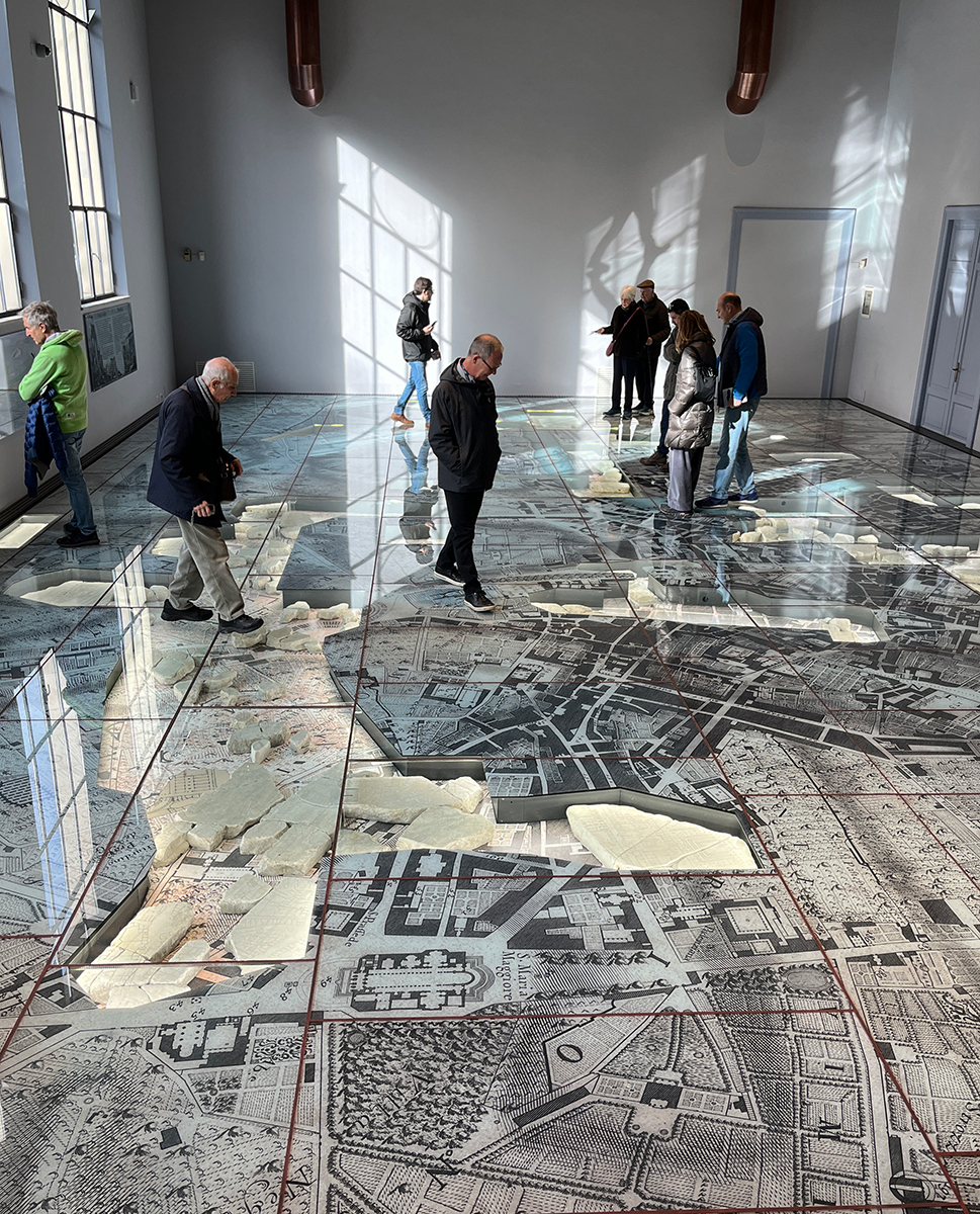
Provided that the glass on the floor doesn’t get too dirty and scratched, this seems like an ideal solution. Right now, it looks great, and it even photographs reasonably well:

The museum is not large, but it is very well done. The main room houses the surviving fragments whose placements are known. Pieces whose placements are uncertain are mounted on the wall and used to help explain some of the symbols that one finds on the map:

There are also small side displays about how the marble slabs were attatched to the wall and about problems with the orientations of some structures on the map. It’s a fantastic display in a small space. The museum is set within the Parco archeologico del Celio just to the south of the Colosseum. Outside the museum is a garden full of interesting inscriptions and architectural fragments. I very much enjoyed spending a morning there.
For anyone interested in the map, also have a look at the Stanford Digital Forma Urbis Romae Project . The page is a bit dated now, but it’s still a solid set of online resources for the study of the marble map. A related useful resource for the topography of Rome is the zoomable online version of Rudolfo Lanciani’s Forma Urbis Romae. which superimposes the modern (1901) street plan of the city on the ancient remains of the city that were known at that time.

